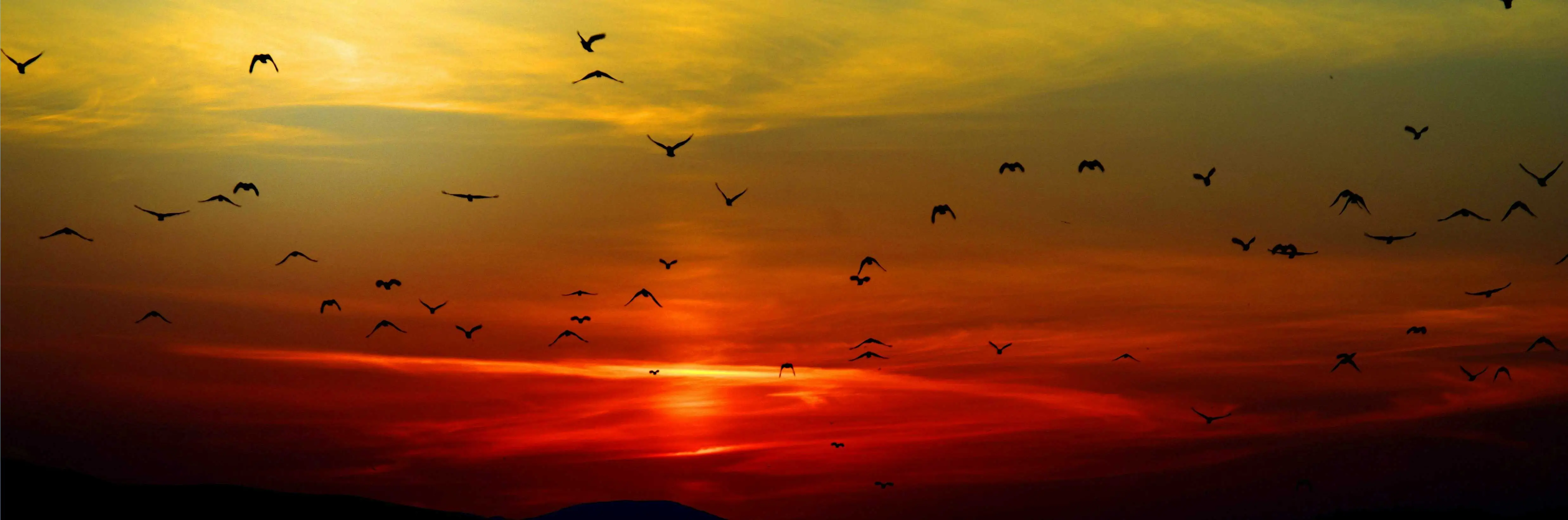
Where the earth opens to reveal the soul of the Andes
The Colca Canyon is not simply a crack in the earth; it is an open wound in the skin of the Andes that reveals, with rawness and beauty, millions of years of geological history. With a depth exceeding 4,000 meters, this natural giant defies gravity and human perception, offering a setting where silence is broken only by the wind sliding through the rocks and the deep beat of the Andean condor's wings.
But beyond its imposing geography, the Colca is a living book. Its slopes are a tapestry of pre-Inca terraces still under cultivation, silent witnesses to an agricultural ingenuity that defied the mountain's verticality to sustain civilizations. Traveling through its towns — Chivay, Yanque or Cabanaconde — means immersing yourself in an Andean worldview where textile traditions, high-altitude cuisine and the warmth of its people intertwine with the majesty of the landscape.
Here, every sunrise paints the snow-capped peaks gold and every sunset stains the abysses red, turning every visit into an almost spiritual experience. Whether you take on its extreme trekking routes, watch the sovereign flight of the condor from the Cruz del Cóndor viewpoint, or let yourself be pampered by hot springs under a blanket of stars, the Colca promises not just a geographic journey, but a reconnection with the essence of Peruvian nature and culture.
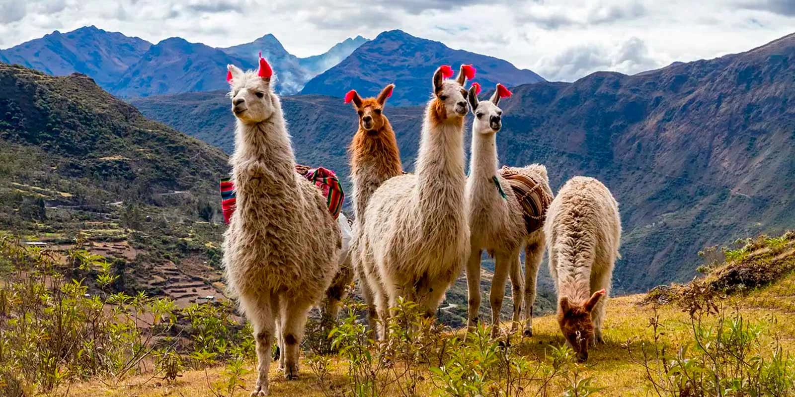
At the Cruz del Cóndor viewpoint, at sunrise, watch these ancient birds ride the canyon's thermal currents.
Follow ancestral paths along agricultural terraces, on routes ranging from gentle walks to the demanding hike to the canyon floor (Sangalle).
Relax in the hot springs of Chivay or Yunza, with temperatures between 38°C and 46°C, ideal after a day of exploring.
Discover rural life in Lari, Maca and Pinchollo, where pottery, hand-loom weaving and traditional festivities are still very much alive.
Ideal for: landscape photography lovers, travelers seeking authentic ecotourism, adventurers who take on high altitudes, and culture seekers wanting to connect with Andean roots.
A lunar landscape where the earth still breathes fire
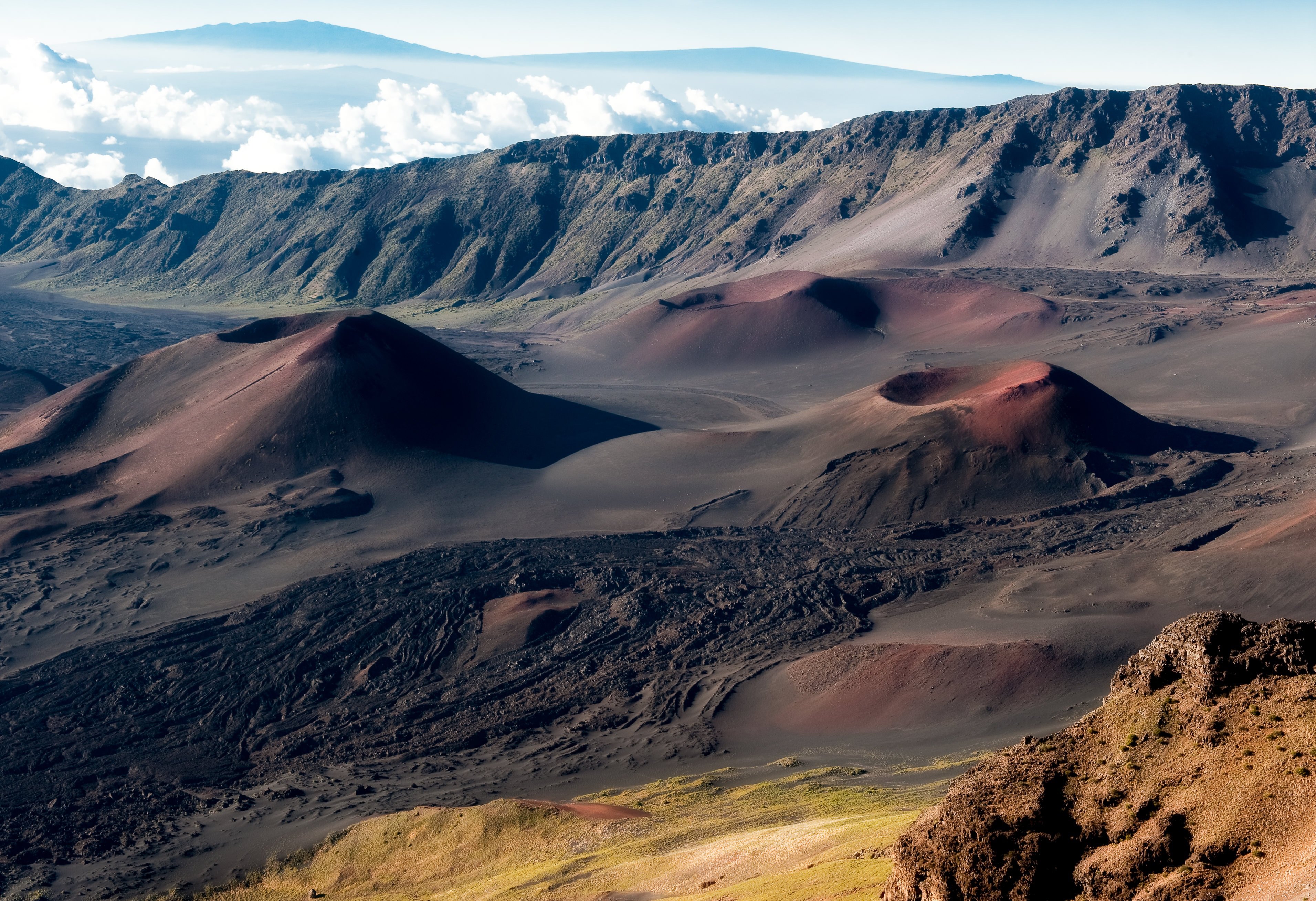
Imagine a place where the ground seems to have been sculpted by giants, where dozens of volcanic cones sprout from the earth like petrified bubbles in a sea of black lava. That is the Valley of the Volcanoes of Andagua: a scene so extreme it seems to come from another planet, a geological rarity few places in the world can match. Located in the heart of the Arequipa Andes, this valley holds more than 80 perfectly preserved volcanic cones, some as small as a person and others exceeding 300 meters in height, all silent witnesses to the igneous fury that shaped this region just a few thousand years ago.
But the Valley of the Volcanoes is not only geology: it is a living territory where Andean culture has learned to coexist with ground formed by ancient fires of the earth. The towns of Andagua, Chachas and Ayo preserve ancestral traditions, colonial temples and terrace farming systems that defy the aridity of the landscape. Here, the volcanoes are not mere rock formations; they are apus, sacred mountains that guard agricultural life, venerated with offerings and rituals still celebrated today.
Since 2019, this incredible destination has been part of the UNESCO Global Geopark "Colca Canyon and Volcanoes of Andagua," a recognition that places it among the most valuable geotourism destinations on the planet. Walking its trails is like walking through an open book of Earth's history, where every cone, every lava flow and every crater tells a story millions of years in the making.
Climb to the top of the Puca Mauras volcano, with its reddish summit and perfect shape, for a panoramic view of the valley. You can also explore the "Twins," two twin volcanoes with easy access from the town.
Follow trekking routes through a forest of volcanoes, fields of solidified lava and pre-Inca archaeological remains such as Maucallaqta. The Shankilay viewpoint offers a spectacular view of the Andagua river's waterfalls.
Laguna de Chachas, with dark waters surrounded by volcanic scenery, is ideal for birdwatching. You can also explore Laguna de Mamacocha, a hidden oasis in the middle of the valley.
The remote location and absence of light pollution make the valley a paradise for landscape and night photography, with clear skies that reveal a stunning blanket of stars.
Ideal for: geotourism enthusiasts, travelers seeking remote and uncrowded destinations, extreme landscape photographers, and adventurers wanting to connect with the living geology of the Andes.
The white heart of the volcano that built a city
Imagine walking between stone walls reaching 40 meters in height, formed by the fury of a volcano that erupted 1.65 million years ago. That is the Sillar Route: a journey to the very origin of Arequipa, the "White City." Here, in the Añashuayco and Culebrillas quarries, the volcanic rock known as ignimbrite becomes sillar in the hands of master quarrymen who inherited ancestral techniques and, still today, under the Arequipa sun, carry on a trade that has shaped the identity of an entire region.
But the Sillar Route is much more than geology. It is an open-air museum where art and tradition merge in more than 60 monumental sculptures carved into the rock walls themselves. It is a cinematic setting where the immaculate white of the stone contrasts with the deep blue of the sky, creating a mesmerizing palette. It is living proof of how the Spanish, seduced by the climate and fertile land, found in this material the perfect ally for building temples, mansions and convents that are today a UNESCO World Heritage Site. And above all, it is an experience where visitors don't just observe, but can touch, feel and even try carving sillar with their own hands.
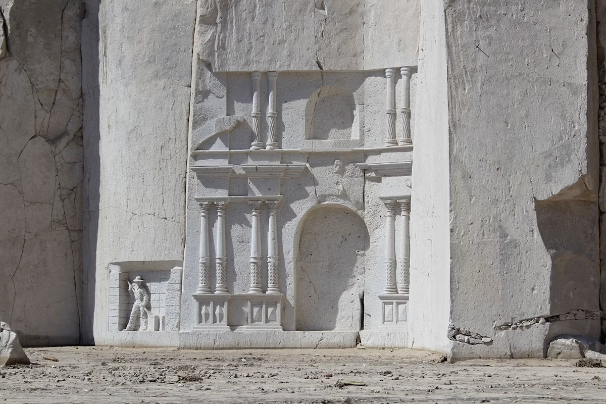
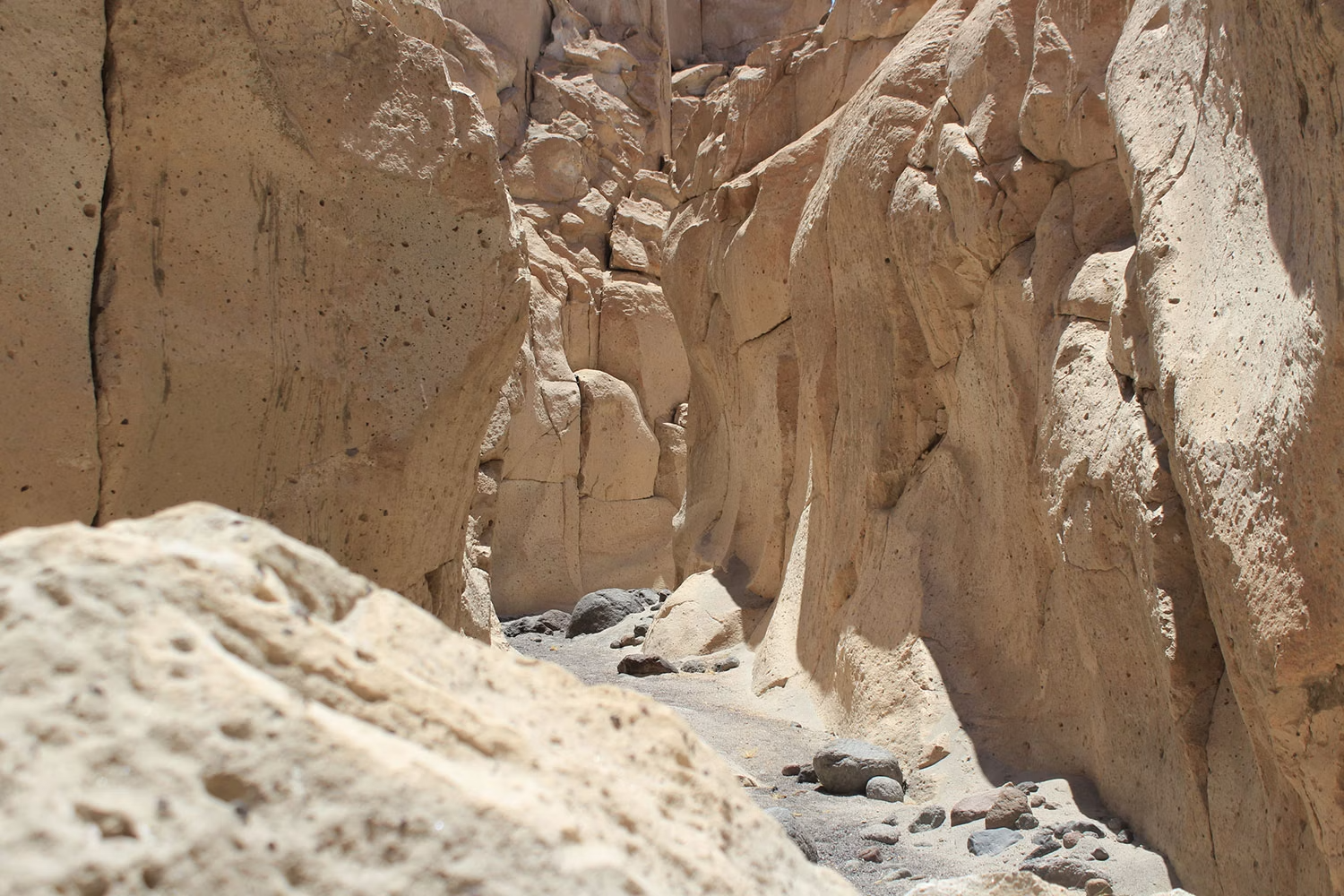
The heart of the route. Walk among cliffs over 40 meters high and marvel at more than 60 monumental sculptures carved in sillar: the condor, the milkmaid, the bullfight, and even the façade of the Compañía church.
A narrow, untouched canyon that feels like a stone labyrinth. Walk its passages for 20 minutes and discover the ancient petroglyphs held within its walls.
Learn from master quarrymen the extraction techniques passed down through generations. You can even try carving sillar yourself, a unique experience.
The white sillar walls, the contrasts of light and shadow, and the views of the Misti, Chachani and Pichu Pichu volcanoes in the background make every corner a perfect setting.
Ideal for: travelers seeking an authentic cultural and artisanal experience, photography lovers, those curious about geology and history, and anyone wanting to understand why Arequipa is called the "White City" by touching the very stone that built it.
The highest stone forest in the Andes
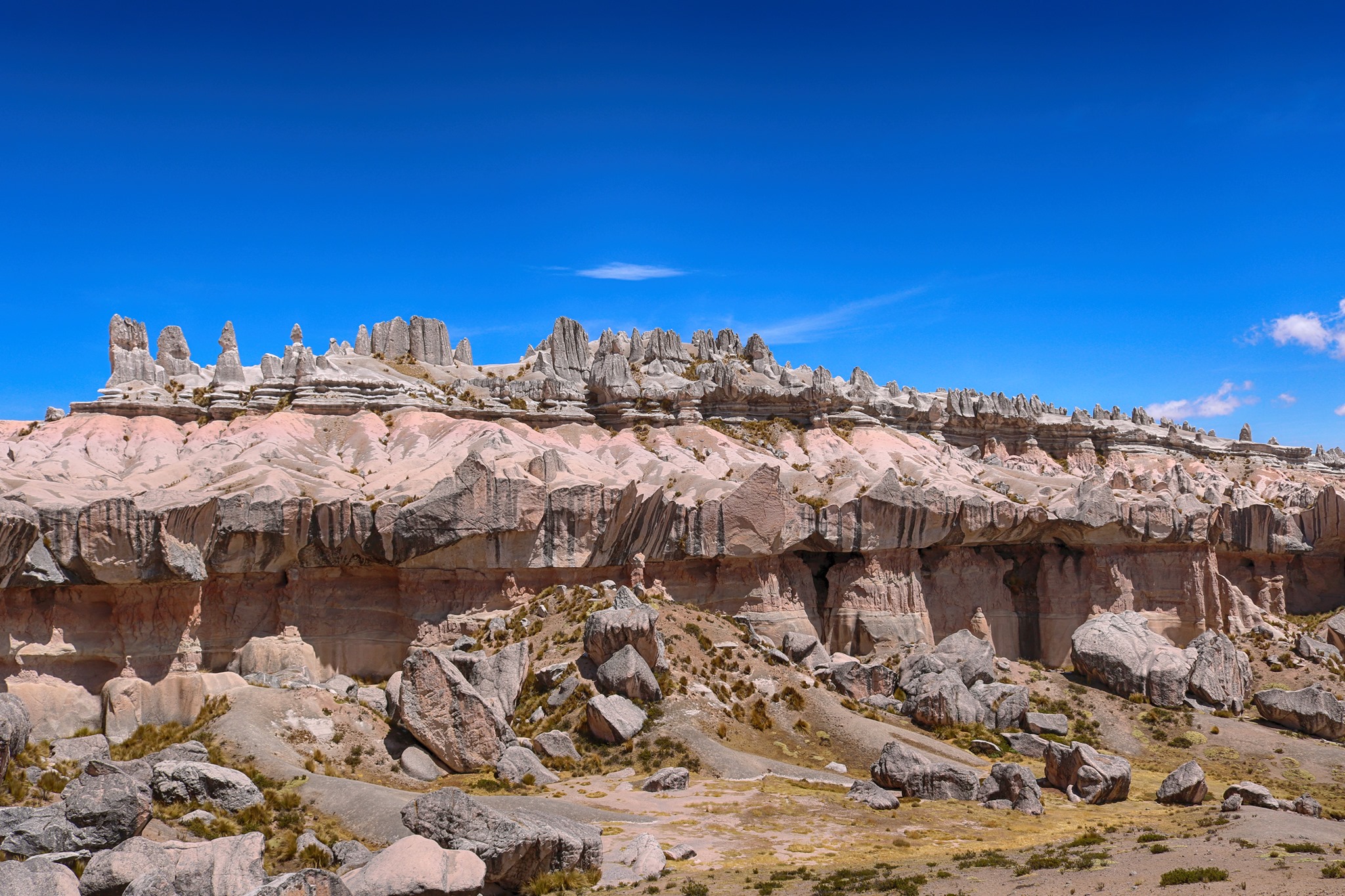
Imagine a place where volcanoes, millions of years ago, spat out ash and molten rock; where wind, water and ice, over millennia, sculpted that rock into a treeless forest, an open-air museum of impossible shapes. That is Choqolaqa: a surreal landscape that defies all logic, a labyrinth of stone giants rising like sentinels in the silence of the highlands, more than 5,000 meters above sea level.
For locals, Choqolaqa is not a simple geological accident. Legend has it that ancient Arequipa was born here — a splendid city of sanctuaries, plazas and majestic buildings. Its inhabitants, in an act of arrogance, offended the apus, the guardian spirits of the mountains. As punishment, the apus turned the entire city to stone, transforming its temples, streets and inhabitants into the rock formations we see today. That is why Choqolaqa is also known as Nauqqa Arequipa or Mawk'a Arequipa, which in Quechua means "Ancient Arequipa."
Walking among these stone sculptures of volcanic sillar is like strolling through the ruins of a petrified city. Some rocks, up to 20 meters tall, take on whimsical shapes that the imagination turns into human figures, animals and objects: a condor about to take flight, a seal with its pup, an enchanted castle, a row of women in traditional dress.
Walk among sillar giants that look carved by divine hands. Let yourself be surprised by whimsical shapes that evoke castles, towers, streets and petrified animals.
The contrast between the white sillar, the deep blue Andean sky and the lengthening shadows at sunset creates a perfect setting. Sunrises and sunsets are especially magical.
The area is home to vicuñas, alpacas and condors, as well as endemic birds and plants adapted to extreme altitudes.
Choqolaqa is a sacred place where the connection between earth and sky is felt. Many communities still hold ceremonies and offerings to the Pachamama here.
Ideal for: travelers seeking remote and uncrowded destinations, extreme landscape photography lovers, adventurers who take on high altitudes, and anyone wanting to walk among the ruins of a legendary city petrified by the gods.